
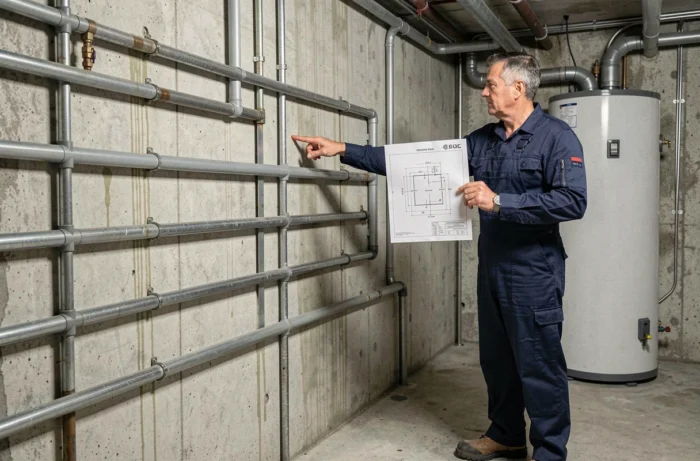
When preparing an extension, whether to lay a terrace or simply to seal a persistent leak, the first question that always arises is the same: where do the pipes run? Without a reliable plan, even the slightest shovel strike becomes a gamble. The plumbing plan of the house is not a decorative document: it is the foundation of any work that touches the ground or walls.
Building permit file at the town hall: the document that no one asks for
When looking for a plumbing plan, the common reflex is to rummage through the notary’s papers or to question the previous owner. One often overlooks a much more comprehensive source: the building permit file archived at the town hall. This file, sometimes referred to as the “property file” or technical file submitted, often contains the “as-built” plumbing and sanitation plans, meaning the plans as constructed, not just as projected.
The distinction matters. A project plan shows an intention. An as-built plan shows what has actually been installed. To access it, one goes to the town hall’s urban planning department with the property’s cadastral reference. The consultation is generally free, and one can request a copy.
Knowing where to find the plumbing plan of the house starts with this administrative step, before any field intervention.
Be careful: if the house has undergone subsequent work (addition of a bathroom, modification of the drainage network, connection to the sewer), the archived plan may be outdated. The actual layout may have changed without the town hall file being updated. Therefore, one can never rely solely on a plan without verification on-site.

Public sanitation network plans: what they show and what they hide
The sanitation service of the municipality (or intermunicipality) has plans of the public sewer network. These can be consulted upon request, sometimes online via the community’s GIS portal. These plans are useful for understanding where the connection point of the house to the sewer system is located.
The trap is believing that these plans cover the private network. Public plans stop at the connection, meaning at the boundary between public domain and private property. Everything that happens between this point and the house is the owner’s responsibility and does not appear on the municipal plan.
To reconstruct the private layout without a plan, one starts by identifying visible elements:
- The manhole covers in the garden or along the house, which mark the inspection points of the buried network
- The drains and floor traps (sometimes called “gully traps”), often placed at rainwater outlets or at the base of gutters
- The wall crossings in the basement or crawl space, which indicate the entry or exit of a pipe
By connecting these points on a sketch, one obtains a probable layout. Probable, not certain. It depends on the installation: some older houses have combined networks (wastewater and rainwater mixed) that complicate reading.
Camera and probe detection: when the plan is no longer enough
A plan found at the town hall dates from the time of construction. A visual inspection of the manholes gives an approximate layout. To obtain a reliable mapping of the actual network, camera and probe detection remains the most precise method.
The principle: a professional inserts a camera into the pipe through a manhole or existing access. The camera progresses through the pipe and transmits a real-time image. An integrated emitting probe allows for locating the exact passage of the pipe from the surface, its depth, and its orientation.
What the camera reveals beyond the layout
The inspection is not limited to localization. It highlights the internal condition of the pipes: cracks, infiltrated roots, partial blockages, back slopes. Sometimes, abandoned sections or illegal connections that do not appear on any plan are discovered.
The cost varies depending on the length of the network and the accessibility of the manholes. For a single-family home, it generally ranges in the hundreds of euros, but feedback varies on this point depending on the region and the provider. The inspection report provides an updated plan of the network with photos, which is kept carefully for any future work.
Sanitation diagnosis and real estate sale: a plan that becomes mandatory
Since the introduction of the mandatory sanitation diagnosis for real estate sales, the plumbing plan is no longer just a comfort: it is a part of the sales file. The diagnosis checks the compliance of the sanitation installation, the proper separation between wastewater and rainwater, and the effective connection to the collective network (or the proper functioning of individual sanitation).
For the seller, having this diagnosis done in advance allows for anticipating any necessary compliance work. For the buyer, it is an opportunity to obtain an up-to-date plan of the network, established by a certified professional.
What to check in the diagnosis report
- The compliance of the connection to the public network or the validity of the individual septic tank
- The effective separation between the wastewater network and the rainwater network
- The absence of undeclared connections or defective sections
- The slope of the drainage, whose insufficiency causes stagnation and recurring blockages
If the diagnosis reveals a non-compliance, the responsibility for bringing it up to standard generally falls to the seller or is subject to negotiation on the sale price.
The plumbing plan of the house is rarely found in one single place. One encounters the building permit file at the town hall, the public network plans at the sanitation service, the visual identification of the manholes on-site, and if necessary, a camera inspection to clear up any remaining doubts. Keeping each document in a single file avoids starting from scratch for the next project or sale.